The European GNSS Agency (GSA) in collaboration with the European Commission requested the development of a mobile solution to support the free movement of essential goods during the current pandemic; as well as to provide Member States with a means to report on their situation and comply with EU recommendations. The result is the Galileo Green Lane application.
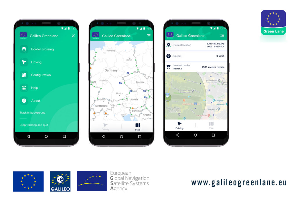
The app leverages the positioning services of Galileo to provide transparency to border authorities and freight transporters on the border crossing times at TEN-T border points. Both parties are able to access a real-time visualisation of the current situation at all TEN-T border points across Europe, as well as contribute to the overall status by providing information. Freight transporters entering a geo-fenced area within a defined distance from a crossing point are notified on the current situation, and their anonymised location data is collected solely to update the overall border picture. Border authorities on the other hand are able to use their experience to classify the waiting time on their application with a geo-tagged photo.
Novaspace took on the challenge of the complex and dynamic coordination and operational management of the initiative; bringing together FoxCom, a leading-edge Czech software architecture and development studio, and Sixfold, a leading Austrian shipment visibility provider, to develop the application.